
Custom Map Illustration Services
From concept to guide
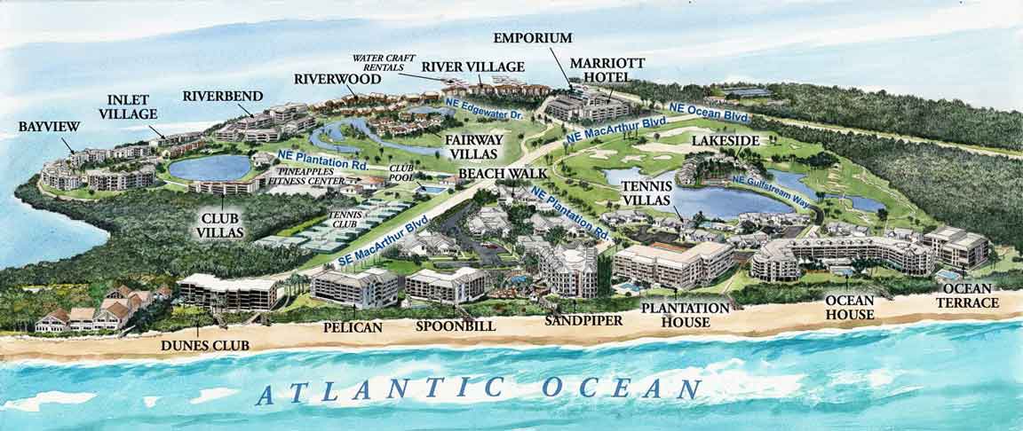
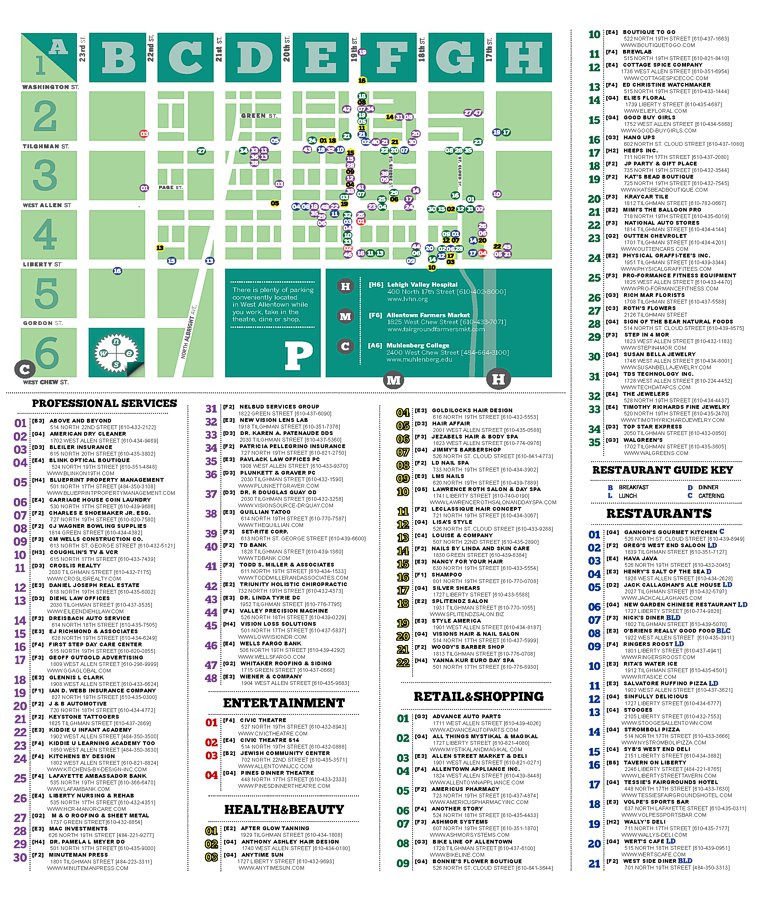
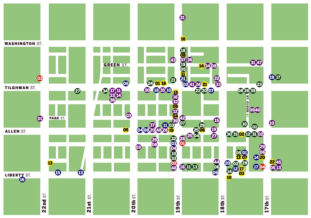
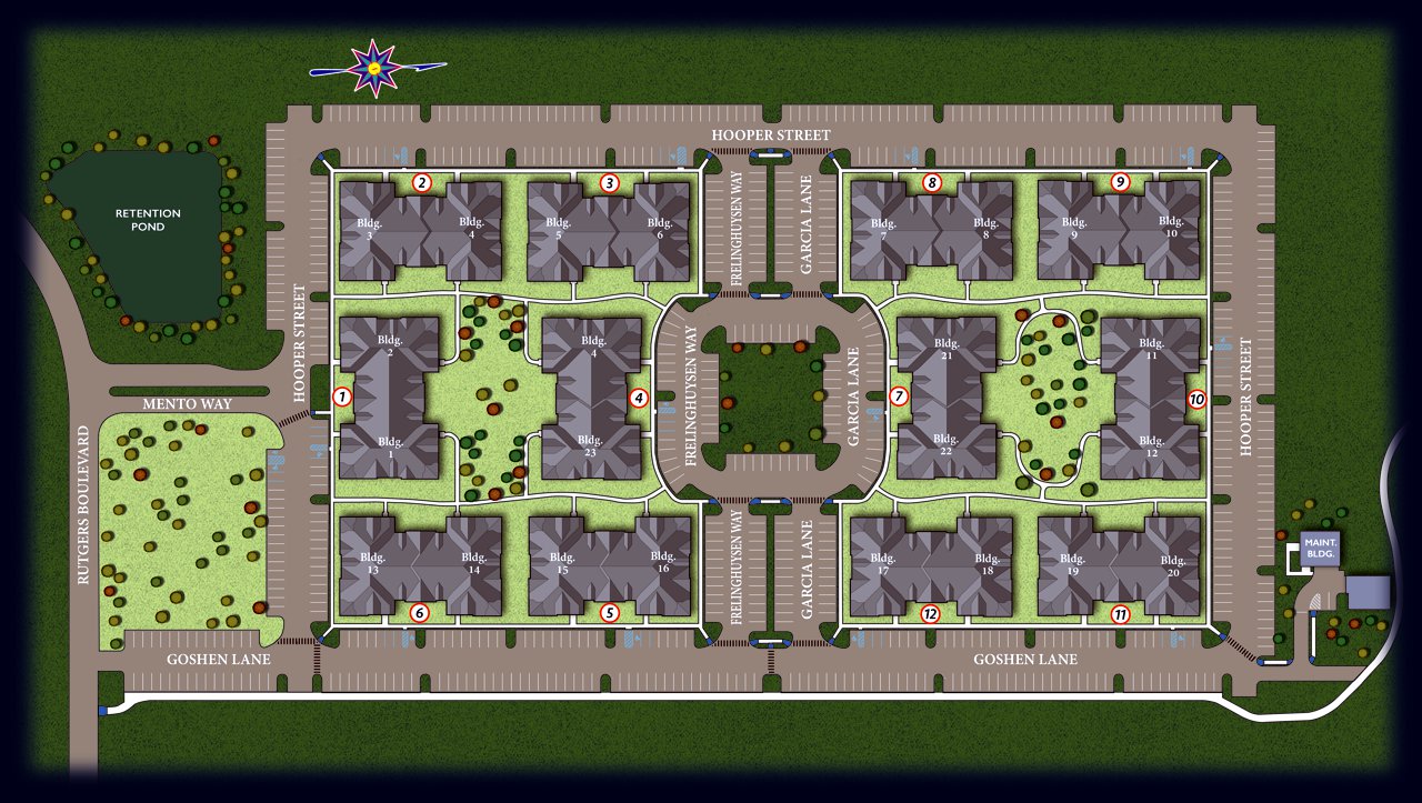
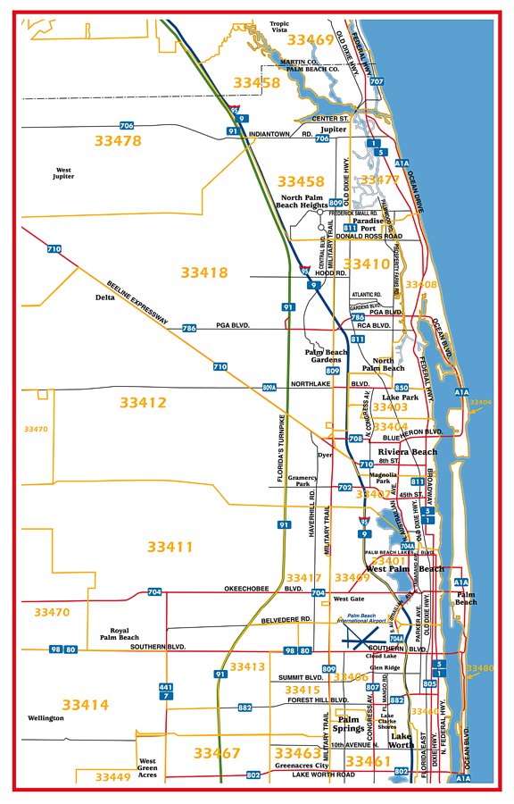
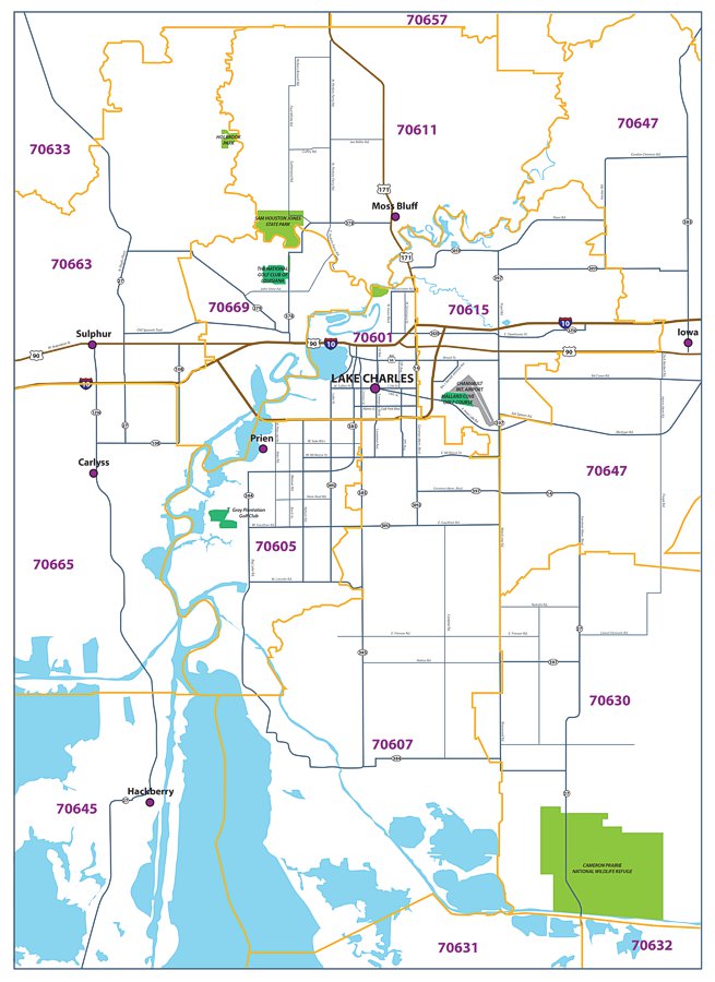
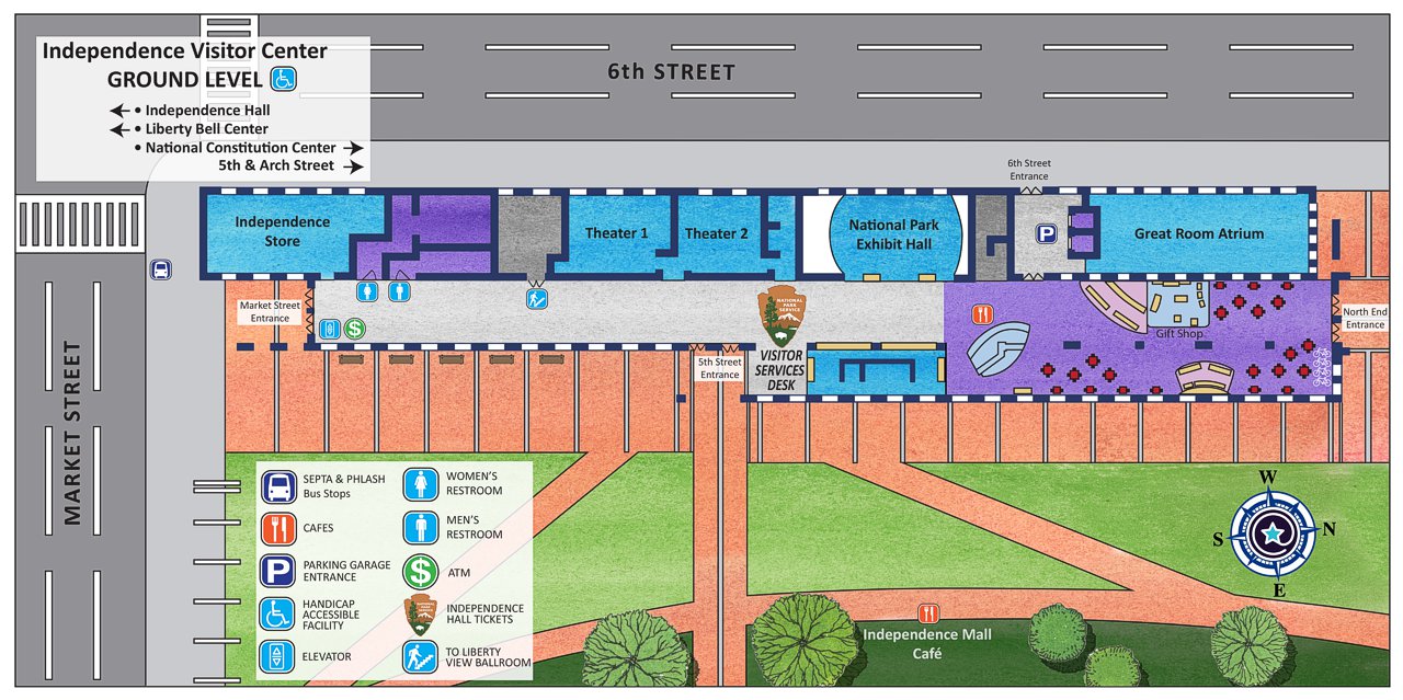
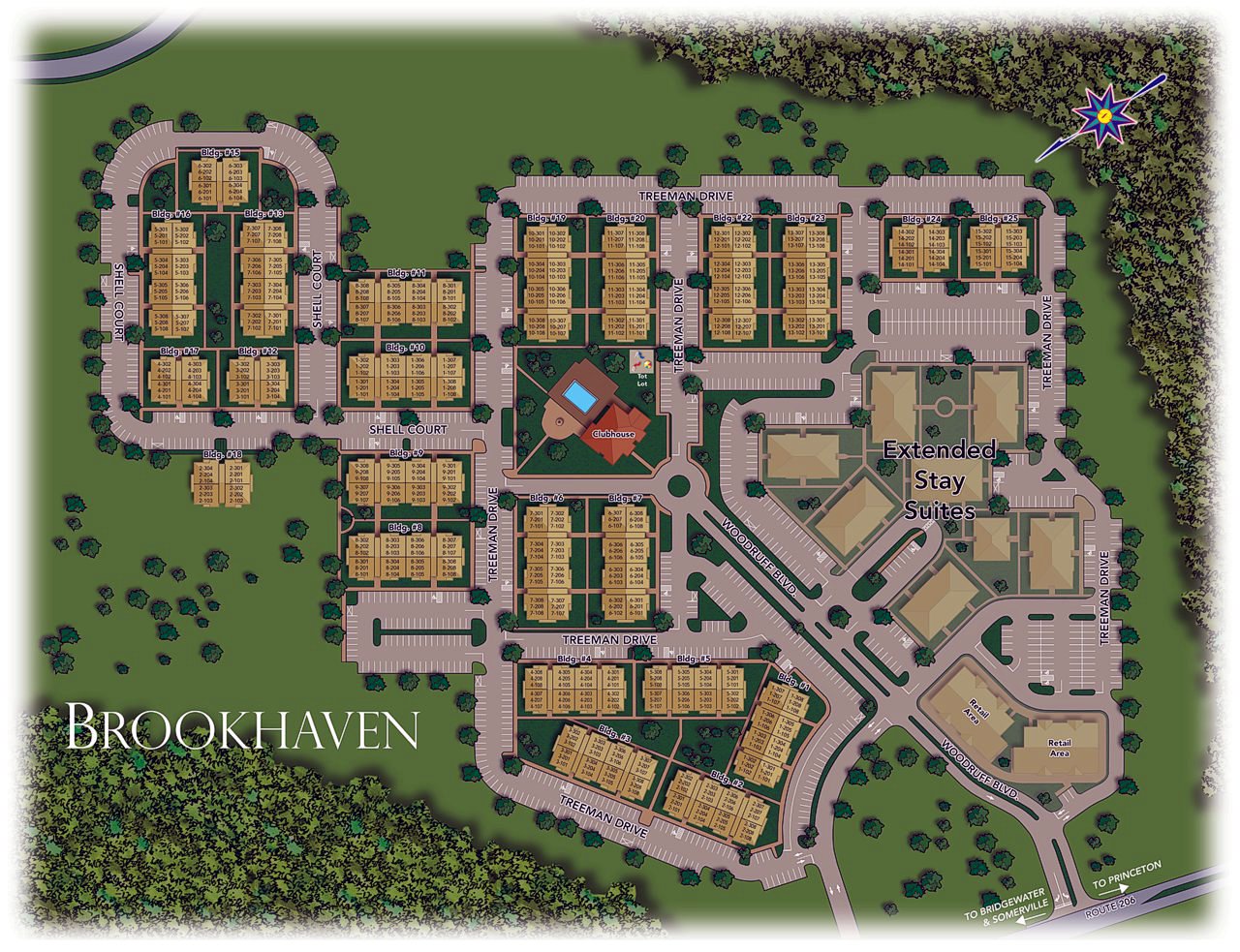
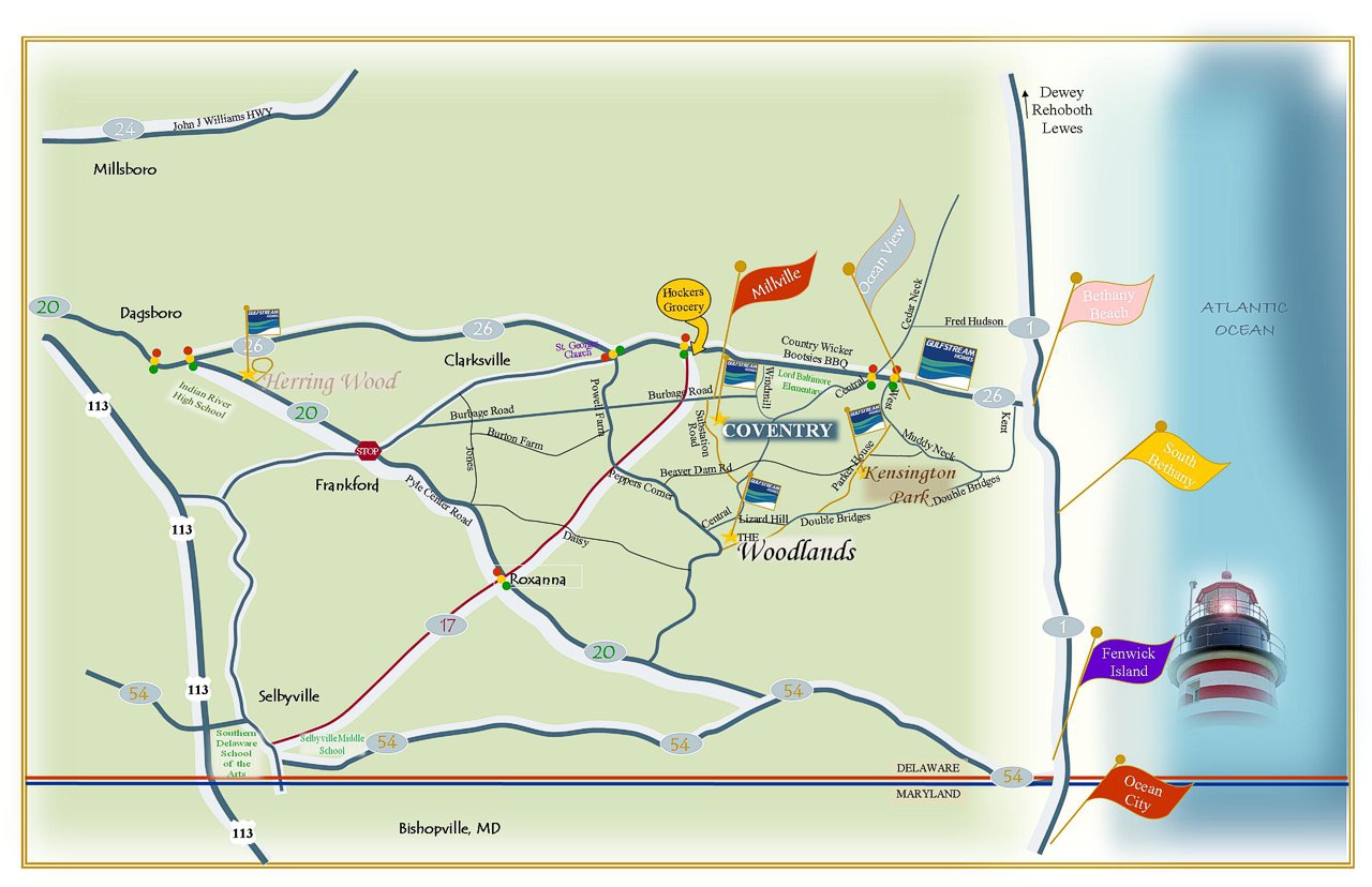
Elevate your marketing materials with a professionally designed, eye-catching custom map from Renderings Now. Whether you need a 3D plat map, a detailed site plan, a directional map, or a full residential community map, our team creates maps that are not only visually striking but also precise and highly functional. We work closely with builders, developers, and event organizers to ensure each map clearly communicates layout, location, and movement, while still aligning beautifully with your brand. Our custom maps are crafted to attract attention, enhance presentations, and help your audience quickly understand the space. When accuracy, clarity, and strong design matter, trust Renderings Now to deliver a map that truly stands out.
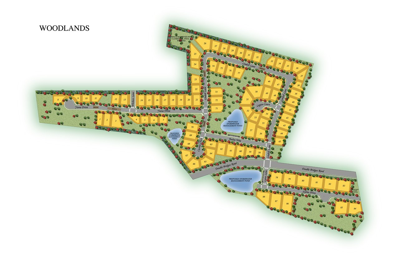
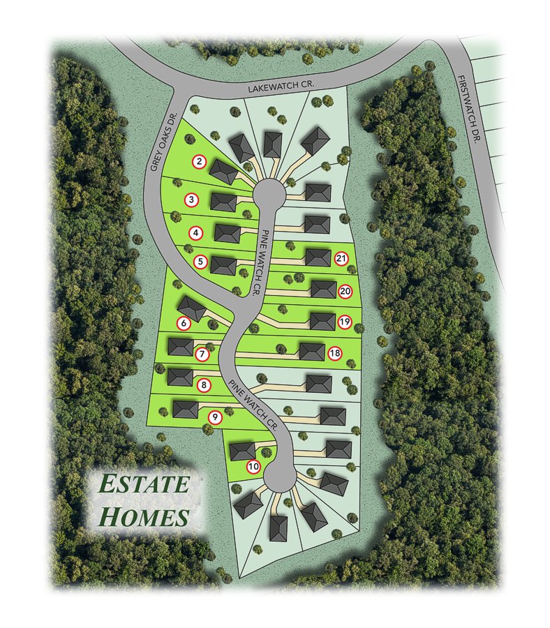
Custom plat maps, community maps, & more
Why Invest in Custom Map Illustrations?
Our custom map illustrations help you showcase your property with clarity, professionalism, and visual impact. Whether you need a plat map to define lot lines and infrastructure or a community map to highlight amenities and layout, our maps make it easy for buyers, stakeholders, and city officials to understand your project at a glance. These detailed and visually engaging maps enhance marketing materials, simplify navigation, and support sales by helping your audience see the full potential of your development. From residential communities to commercial sites, our custom map illustrations are designed to inform, impress, and drive engagement- giving you a powerful tool to move your project forward with confidence.
Features
Your plans are our passion. Discover what we can offer.
Full Color Map Illustrations
We can illustrate every aspect of your design, event, site, or community with visually engaging detail.
Adaptable File Formats
Receive plans in web-ready or print-ready formats, suitable for everything from MLS listings to large-format signage.
Landscaping & Finishes
Environments and finishing touches are carefully considered in order to show off your project in the best light.
Custom Branding Available
Add your logo, company colors, and contact info to create cohesive, on-brand marketing materials.
High Definition Deliverables
Crisp, high-resolution files optimized for web, print, and presentations.
Express Service Options
Fast-track delivery for projects when you're on a tight deadline.
Detailed Interiors & Exteriors
We can illustrate every aspect of your design, setting the tone for both indoor and outdoor spaces.
Drone and Aerial Views
Need multiple camera angles? With 3D rendering technology, the perspective of your images is customizable.
Landscaping & Finishes
Environments and finishing touches are carefully considered in order to show off your project in the best light.
2D & 3D Floor Plans
Clear, accurate, and detailed layouts that make every plan easy to visualize and work off of.
High Definition Deliverables
Crisp, high-resolution files optimized for web, print, and presentations.
Express Service Options
Fast-track delivery for projects when you’re on a tight deadline.
Your Industry is Our Specialty
Who can benefit from Commercial Rendering services?
Professionally designed custom map illustrations help professionals across real estate, design, and planning communicate space with clarity and impact. Whether you’re developing a residential community, managing a commercial site, or organizing an event, Renderings Now creates detailed, visually engaging maps tailored to your needs.
Builders, developers, and architects use custom maps to showcase site layouts, plat divisions, and amenities for presentations, marketing, and approval processes. Marketing teams and creative agencies integrate them into brochures, websites, and signage to elevate branding and drive engagement. Property managers, HOAs, and event organizers also benefit from accurate, easy-to-read maps for navigation and public display.
From master-planned neighborhoods to site plans and festival layouts, our custom map illustrations are scalable, brand-aligned, and designed to make your project clear, professional, and memorable.
Renderings Now Can Illustrate:
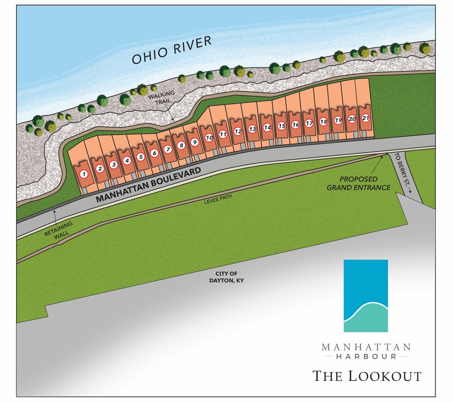
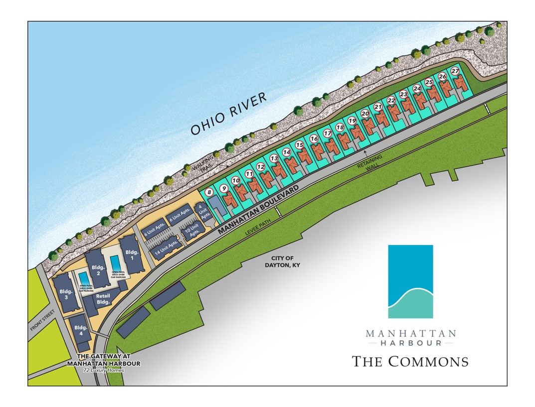
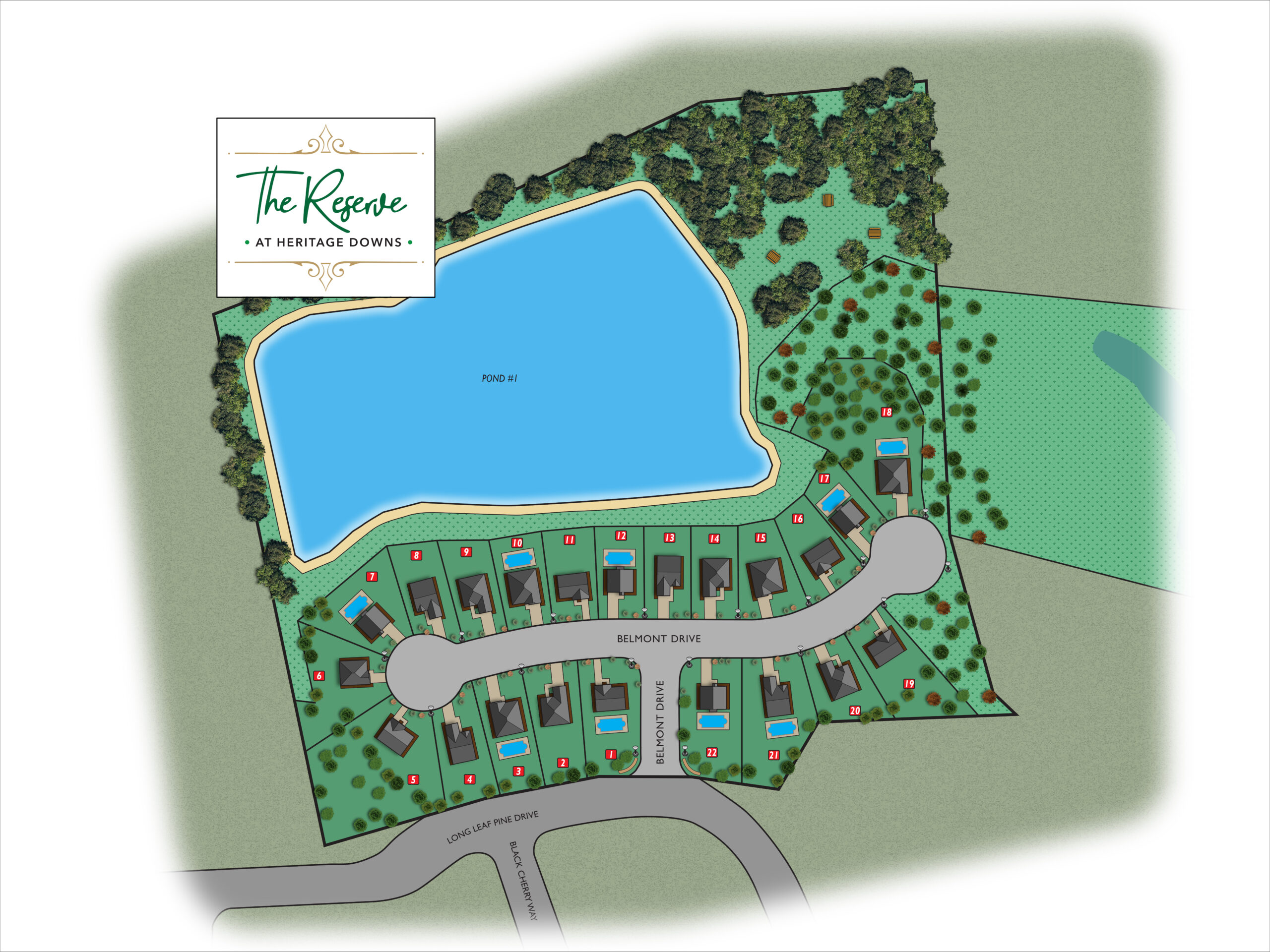
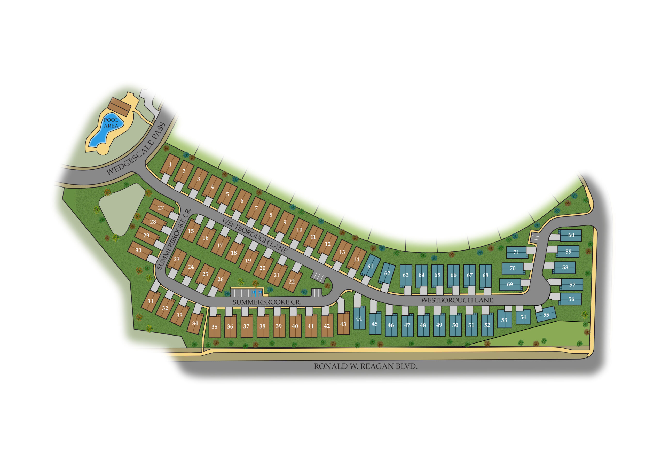
- Plat Maps
- Site Maps
- Community Maps
- Event Maps
- & More!
Get Started
Have questions? We’re here to help.
Ready to reach out?
Send us a message.
Frequently Asked Questions
Are your maps to scale?
Yes, we can create to-scale maps when accurate dimensions and measurements are provided. If exact scale isn’t needed, we can design maps for visual clarity and layout illustration purposes.
Can you match the map to my brand or project style?
Absolutely. We can incorporate your logo, brand colors, font styles, and other visual elements to ensure consistency across your marketing materials.
What file formats will I receive?
We deliver high-resolution files suitable for both print and digital use, including PDF, PNG, and JPEG formats. Editable files (such as Illustrator or layered PSD) can also be provided upon request.
Do you offer revisions to ensure the map matches my vision?
Yes, we offer revisions to ensure your custom map matches your vision. Our process is designed to be collaborative, giving you the opportunity to review drafts and request adjustments.
What is the typical turnaround time for a map project?
The typical turnaround time for a custom map project depends on the scope and level of detail, but most are completed within 1–2 weeks. Smaller residential maps may be delivered even faster, while large-scale projects may take additional time. For clients working on tight deadlines, we also offer express services to ensure you receive high-quality visuals exactly when you need them. Our team works efficiently without compromising on accuracy or detail, making it easy to meet project milestones and presentation dates.
Do you provide map illustrations optimized for both web and print?
Yes, we deliver custom map illustrations optimized for both web and print. Our high-resolution images are formatted for brochures, flyers, and prints, while web-ready versions are compressed for fast loading on websites, listings, and social media. Whether you need to showcase a development online or need physical materials for events and presentations, we tailor the output to fit your exact needs.
Are large-format images available?
Yes. Our standard map illustrations are provided as high-resolution images- perfect for online use, presentations, and most print materials. If you’re planning something big, like a display board or a large-format wall print, we can upgrade your image to an ultra-high resolution. Just let us know your needs, and we’ll ensure your map looks sharp whether it’s seen up close or from across the room.
Our Portfolio
See what Renderings Now can do for you.
